50 USA Places That Make No Sense (Until You Know Why)
2.7M views · Jan 21, 2025 · Education

Comments · 1.5K
@MapPack · 1 year ago · pinned
CORRECTION:<br>Fact #47: The images shown are not of Crater Lake. They were intended to represent it due to copyright issues. I understand the concern and will work to secure proper rights in the future.
498
@danekappler2422 · 1 year ago
The biggest difference between alligators and crocodiles is that one of them will "see you later", while the other will be back, "after a while".
453
@knifeislandresort · 1 year ago
Glad we are all here to say "That tiny pond isn't Crater Lake". Don't disrespect Wizard Island like that.
247
@paulekylou · 1 year ago
LOL good to see people know enough geography to know that’s not Crater Lake lol
180
@pickleballer1729 · 1 year ago (edited)
Hah! My stepfather who lived in NY for many years told me about Lake Charg... when I was about 15. That's been one of my favorite trivia Q's for most of my life. And yes, I can pronounce the name, although my stepfather did tell me that the translation was "You fish on your side of the river, I'll fish on my side, and no one fishes in the middle.<br><br>And about how big Texas is: I worked in a hotel in Dallas and asked one of our guests about his trip. He had come in from El Paso because the home office in Omaha Nebraska had told him to "pop om over there" and take care of some problem. He replied, "Why don't you? You're closer.", which is true. They still made him go to Dallas.
67
@billmullins6833 · 1 year ago
Regarding the size of Texas: The video talked about the distance between El Paso and Houston but Houston is pretty far from the eastern border. Beaumont is ON Texas' eastern border. The distance (straight line, road is farther since IH10 dips south to go through San Antonio) from Beaumont to El Paso is truly amazing. If you are in either Beaumont or El Paso, it is a far shorter trip to go to the nearest ocean (Pacific for El Paso, Atlantic for Beaumont) than to cross Texas. If you folded Texas eastward from Beaumont, El Paso would be out in the Atlantic. Likewise, if you folded Texas westward from El Paso then Beaumont would be well out into the Pacific. Fun fact, if you folded Texas northward, Brownsville would only be about 50 miles from CANADA!
56
@brianbarry5673 · 1 year ago
If you ever do an episode on Facts about Canada, my favorite fact is that if you drew a line through Canada's Capitol (Parliament Hill, Ottawa) which is about 40 miles north of the US border, approximately 50% of Canada's population would be below the line and 50% would be above. With a total population of 40 million that would be 20 million above and 20 million below. Also, about 11 million Americans live above the line.
6
@Just1Nora · 1 year ago
<a href="https://www.youtube.com/watch?v=HS4Q1ETTSBc&t=56">0:56</a> This absolutely gave me, "Darmok and Jalad at Tanagra," vibes. 😂😂😂
19
@escargo0133 · 1 year ago (edited)
Another interesting fact. Mouna Kea on the island of Hawaii is actually the largest mountain in the world when measured from the mountains base to it's summit. Mauna Kea Volcano rises 13,796 feet above sea level but extends about 19,700 feet below sea level to meet the ocean floor. So when Mouna Kea is measured from it's actual mountain base it rises a whopping 33,496 ft while Mount Everest is only a measly 29,032 feet tall.
40
@NorthStateLiberty · 1 year ago
Ummm....that's not crater lake
501
@EricLane3D · 1 year ago
corrections on fact 33: that is not a Bristlecone Pine shown. also Don Currey did not cut down the tree, known as Prometheus, when he found out it was older. he was studying the little ice age and dendrochronology where tree core samples are useful for this type of research. he obtained permission from the National Forrest Service to cut down a tree because he could not get reliable core samples. it was only after cutting it down, that he realized it was older than Methuselah. after this he actually took part in lobbying for the creation of Great Basin NP among other conservation efforts.
16
@barbarahurwitz9018 · 1 year ago
We also called Webster Lake -Lake Manchog and thought it meant “ I’ll fish on my side you fish on your side and no one will fish in the middle”
16
Up next

50 Places That Aren’t Where You Think They Are
Map Pack · 723K views

Poland Just Did Something BRUTAL To Bypass Kaliningrad... Putin's Trap BACKFIRED
PPR GLOBAL · 1.3M views

50 US Geography Lies YOU Still Believes
Map Pack · 2.9M views
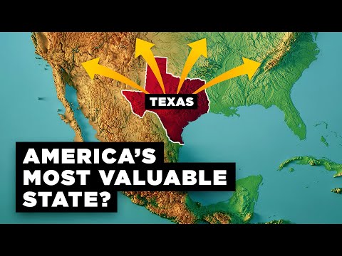
Why Texas is Becoming America's Most Powerful State
RealLifeLore · 10M views

What Did People in Ancient Rome Actually Do All Day?
Rome Unscrolled and Before Civilization · 1.3M views

50 Geography Facts That Are Fake (But You Believed Them)
Map Pack · 265K views

ALASKA • COLORADO • MONTANA WHEN FROZEN GROUND MELTS
DAN precipitation · 117 views

7 Desert Discoveries That Still Defy Explanation
Public Boss · 59K views

The US Empire You Never Knew Existed
Map Pack · 424K views

Top 10 Dark Evidence That Proves Parallel Universes Exist
MostAmazingTop10 · 447K views

World's Most Mysterious Ancient Structures We Still Can’t Explain
My Unreal Planet TV · 822K views

Most Common Myths People Get Wrong About the World
Map Pack · 129K views

How the United States of America Expanded (1776-1900)
The Infographics Show · 1.3M views

4.5 Billion Years of Earth's History in JUST 1 Hour | Full Documentary
Wild Horizons · 2.8M views

Why The US Is Really 12 Nations (Not 50 States)
Geography By Geoff · 1.8M views

50 Borders That Make Zero Sense (Until You Know Why)
Map Pack · 576K views

50 Insane US Geography Facts That Seem Fake But Are 100% Real
The Infographics Show · 965K views

Why These 13 Countries Won't Exist By 2050 (It's NOT War )
Map Pack · 204K views

Why US Geography Makes ZERO SENSE to the Rest of the World
Map Pack · 477K views

300 Secret Historical Photos You Were Never Supposed to See
WhoRemembers ? · 4.4M views